After a light breakfast at the hotel, I finished packing the car. Headed North from Tucson on highway 77. Was planning to stopping by in Globe, but before I knew it, I was through the edge of town.
I had driven North from Globe and to the Salt River Canyon. Just befire the canyon, I noticed abandonded buidinf - sign say Seneca. Did a drive-through the area, down to the lake. Took some photos.
Back on the highway, stopped along the road shooting photos of the canyon. Will add some of these photos to the website page from a previous through the canyon.
Stopped in Slow Low to use the restroom and pick up maps & information. I went up to St. Johns, gassed up and got some snacks before heading East via the road through Ramah. Caught in rushhour getting home - about 5pm. Was exhausted.
Showing posts with label historic. Show all posts
Tuesday, February 12, 2019
Thursday, February 7, 2019
Moving Day
After breakfast at the ranch, I finished packing bag for moving into town (Tombstone} for two nights. It has been may years since that I was so sad to leave the location. The people at the Tombstone Monument Guest Ranch really make you comfortable, like that family.
Heading to retreive the car, stopped on the street and visited with a guest from New Zealand. He and his wife are visitng the area during a 10 day trip to US. Found out his heritage is also Danish! Nice chat. Gave hime a copy of my calendar.
When I got into town, it was too early to check into my motel. Went to the noon reenactment of the "Gunfight at the OK Corral". From there, heaaded down the street to Big Nose Kate's for lunch. Met ham radio friend Terry Zipes and his wife. Had a bacon sheeseburger, fries, and a 22 oz mug ot Kilt
Lifter. Then checked into my motel. Settled into the room and processed photos.
Heading to retreive the car, stopped on the street and visited with a guest from New Zealand. He and his wife are visitng the area during a 10 day trip to US. Found out his heritage is also Danish! Nice chat. Gave hime a copy of my calendar.
When I got into town, it was too early to check into my motel. Went to the noon reenactment of the "Gunfight at the OK Corral". From there, heaaded down the street to Big Nose Kate's for lunch. Met ham radio friend Terry Zipes and his wife. Had a bacon sheeseburger, fries, and a 22 oz mug ot Kilt
Lifter. Then checked into my motel. Settled into the room and processed photos.
Sunday, May 6, 2018
Busy Sunday
Late departure from the motel. Destination for the day was Fort Bayard and downtown Silver City. The Fort did nit open until 10am on Sunday. Visited with the volunteers at the one open building. From there, did a driving tour of the fort.
Next spot was downtown. Parked and took several photos of the historic building in tow, There even is the Murray Hotel with an art deco facade.
It was only about noon, and I was not ready to go to the motel to pack. Decided to do the 65 miles to Glenwood and the Catwalk National Trail.
Grabbed my walking stick (sure happy I brought it) and headed out up the trail. The trail stats as a paved trail. At one place, there is option to continue the paved, easier trail or a dirt, steeper trail. I opted to say on the paved trail.
It was a bit of a hike up the trails before the catwalk starts. Several times I thought of stopping and just heading back. But, with a rest (unfortunately no benched along the trail) I persevered. Eventually I got to the catwalk. Continues the catwalk trail until in ends with a ground level trail. /
There were 2 benches on the catwalk, took time to rest, get a photo of me, before heading back down to the car. Was relieved when I made it back at the car, Guzzled a bottle of Gaterade and headed back to the motel.
Packed up the room and went back to the Wrangler for dinner. Had their French Dip with side of potato salad washed down with 2 pints of Amber Bock. Back at the motel, I crashed into bed.
Next spot was downtown. Parked and took several photos of the historic building in tow, There even is the Murray Hotel with an art deco facade.
It was only about noon, and I was not ready to go to the motel to pack. Decided to do the 65 miles to Glenwood and the Catwalk National Trail.
Grabbed my walking stick (sure happy I brought it) and headed out up the trail. The trail stats as a paved trail. At one place, there is option to continue the paved, easier trail or a dirt, steeper trail. I opted to say on the paved trail.
It was a bit of a hike up the trails before the catwalk starts. Several times I thought of stopping and just heading back. But, with a rest (unfortunately no benched along the trail) I persevered. Eventually I got to the catwalk. Continues the catwalk trail until in ends with a ground level trail. /
There were 2 benches on the catwalk, took time to rest, get a photo of me, before heading back down to the car. Was relieved when I made it back at the car, Guzzled a bottle of Gaterade and headed back to the motel.
Packed up the room and went back to the Wrangler for dinner. Had their French Dip with side of potato salad washed down with 2 pints of Amber Bock. Back at the motel, I crashed into bed.
Thursday, May 3, 2018
T or C to Silver City
After a waffle and several glasses of apple juice, I headed off toward Silver City (taking a tourist route). First on the route were several "ghost towns" NW of T or C - Monticello, Winston, and Chloride.
In Chloride I tourist the museum and store then. Spend so time visited with the "owner", a life-long resident of Chloride. Her grandfather was born in Wisconsin and published his memoirs "Confessions of a Wisconsin Farmm Boy". Sure sounded like I have been working on,
Drove through, but not stopp, in Hillsboro and Kingston. I noticed that the General Store and Cafe in Hillsboro was not open - just hope it has not gone out of business. On up the Black Range. Stopped at a view area. There was a display about the Silver City forest fire.
Since I had time, I detoured to "City of Rocks" State Park. Purchased my annual state park pass.The park is mostly camping spots and some hiking and mountain bike trails. Interesting rock formations out in the New Mexico desert. Shot many photos of the rock outcropping.
Was thinking of picking up a t-shirt at the sate park, but after I paid for my annual pass, they basically ignored me, They talked among themselves not paying any attention to me.From City of Rocks,
Checked into the Motel 6 in Silver CityIt was great - then gave me a room very near the lobby and entrance. Settled into the room and then headed to Wrangler Grill & Bar. Had 2 pints of Amber Bock and their taco plate. Had a nice conversation with a local "snowbird" Spends Winters in Silcer Cioty and Summers next to Acadia National Park.
In Chloride I tourist the museum and store then. Spend so time visited with the "owner", a life-long resident of Chloride. Her grandfather was born in Wisconsin and published his memoirs "Confessions of a Wisconsin Farmm Boy". Sure sounded like I have been working on,
Drove through, but not stopp, in Hillsboro and Kingston. I noticed that the General Store and Cafe in Hillsboro was not open - just hope it has not gone out of business. On up the Black Range. Stopped at a view area. There was a display about the Silver City forest fire.
Since I had time, I detoured to "City of Rocks" State Park. Purchased my annual state park pass.The park is mostly camping spots and some hiking and mountain bike trails. Interesting rock formations out in the New Mexico desert. Shot many photos of the rock outcropping.
Was thinking of picking up a t-shirt at the sate park, but after I paid for my annual pass, they basically ignored me, They talked among themselves not paying any attention to me.From City of Rocks,
Checked into the Motel 6 in Silver CityIt was great - then gave me a room very near the lobby and entrance. Settled into the room and then headed to Wrangler Grill & Bar. Had 2 pints of Amber Bock and their taco plate. Had a nice conversation with a local "snowbird" Spends Winters in Silcer Cioty and Summers next to Acadia National Park.
Labels:
brew,
food,
historic,
Memoirs,
mountain,
New Mexico,
photography,
ruins,
unusual
Wednesday, December 13, 2017
Ruidoso Area Pages
My website pages for the tour in the Ruidoso, NM Area are posted. The pages include photos of the Cloudcroft Trestle and vicinity, Lincoln, NM, Fort Stanton, Smokey Bear Historic Park, White Oaks, NM and Valley of Fired Recreation Area.
This photo is of the Catholic Chapel at Fort Stanton.
Labels:
abandoned,
buildings,
historic,
landscape,
New Mexico
Wednesday, November 29, 2017
Heading Home
Did not sleep well Monday night. That's typical when I am driving. Packed the room and had a bowl of cereal. Checked out of the room and headed toward home.
First stop was to check out the "ghost" town of White Oaks. The bar in town is only open Fridays through Sunday. Took a couple photos of the old buildings. Amazing there is a large, 2-story school house out here in nowhere.
From there,I checked out Valley of Fires Recreational Area. Very different to the VOF near Las Vegas, this valley gets its name from the volcanic activity in the area. My Seniors Pass was only good for half price entrance. Bought a ghost towns book at the visitor's center and visited with the attendant. There was not much to do see there than the lava field and many places to park RVs or have a picnic.
Was time to high-tail it home. Took US 380 to I-25 on up to Rio Rancho. Home a little after 1 pm. Grabbed the mail and processed the day's photos. Exhausted, so napped. Unpacking the car and starting laundry can wait until tomorro
First stop was to check out the "ghost" town of White Oaks. The bar in town is only open Fridays through Sunday. Took a couple photos of the old buildings. Amazing there is a large, 2-story school house out here in nowhere.
From there,I checked out Valley of Fires Recreational Area. Very different to the VOF near Las Vegas, this valley gets its name from the volcanic activity in the area. My Seniors Pass was only good for half price entrance. Bought a ghost towns book at the visitor's center and visited with the attendant. There was not much to do see there than the lava field and many places to park RVs or have a picnic.
Was time to high-tail it home. Took US 380 to I-25 on up to Rio Rancho. Home a little after 1 pm. Grabbed the mail and processed the day's photos. Exhausted, so napped. Unpacking the car and starting laundry can wait until tomorro
Monday, June 19, 2017
Bodie State Park
Just a few mile from Lee Vining was the road to Bodie, CA. The ghost town of Bodie. The dry climate has helped the preservation of the structure in this town. The state has turned in into a state historic park.
It was very interesting to see this old town in the mountains of California. Walked part way in town, until my legs were telling me to turn back because I still have to walk back to the parking lot. Did take s rest and visited for a California local before the return walk.
Drove the mountain roads to South Lake Tahoe. Too early to find and check into my room. drove the roads around the lake. Took at some photos on the California side of the lake. Back in S. Lake Tahoe, it was time to find my room and settle in for the night. By the time I got into my room, I was too tired to think about finding food. Processed the day's photos and crashed into bed.
On to Reno and my Army Reunion...
It was very interesting to see this old town in the mountains of California. Walked part way in town, until my legs were telling me to turn back because I still have to walk back to the parking lot. Did take s rest and visited for a California local before the return walk.
Drove the mountain roads to South Lake Tahoe. Too early to find and check into my room. drove the roads around the lake. Took at some photos on the California side of the lake. Back in S. Lake Tahoe, it was time to find my room and settle in for the night. By the time I got into my room, I was too tired to think about finding food. Processed the day's photos and crashed into bed.
On to Reno and my Army Reunion...
Saturday, April 1, 2017
Trinity Site
New Mexico played an important part in the development of the atomic bomb.
Los Alamos National Lab was constructed in the mountains of North central New Mexico to research and build the first bomb. The town of Los Alamos grew as the need for housing for the scientists and technicians.
The location for testing the first bomb was selected as the Alamogordo Bombing and Gunnery Range in New Mexico. Later, the range became White Sands Missile Range.
Trinity Site is a National Historic Landmark. The landmark is a 51,500 acre area on the White Sands Missile Range. The site is open 2 days a year - the first Saturday of April and the first Saturday of October. http://www.wsmr.army.mil/PAO/Trinity/Pages/Home.aspx
This morning, my cousin and I were out of Albuquerque at "O-Dark-30". Stopped into Socorro for a light breakfast and heading to the site. From the San Antonio exit of I-25, head East about 11-12 miles to the road to Stallion Gate. There was a line of vehicles waiting for access to the site when we arrived about 8am. It took us an hour to get to the gate. (see upper photo).
He had no problems getting onto the range (you need your state government ID or passport for every occupant and the insurance certificate and registration for your vehicle). Another 15 miles or so we were at the parking lot for viewing the site.
When we arrived the site, my cousin and I estimated that had to be nearly 1000 people that were already here or already leaving the site. It is about 1/4 mile walk from the parking lot to the site. Thankfully, there was a large "golf cart" (8-10 person) with driver to carry "handicapped" visitors. With my knee problems, I availed myself of the ride to the site.
Of course, everyone wanted a photo of themselves or family at the ground zero marker (see photo to the right). There are remains of the of the original 100 foot tower (basically nothing). On the fence to the far side of the site had photos of the detonation, and some of the people that were out at the site. There was ever a "polo" teams at the site! There is a covered shelter protecting the portion of the original crated cause by the detonation.
The bring in a "fatman" casing on a trailer to show the basic size of the bomb. The last stop for me at the site was a stop at the the National Park Service vendor to get at least a bood about the test. Ended up with a good book, at DVD and hat pin.
From there, Don and I boarded the bus taking us over to the McDonald Ranch House. This was where the plutonium core of the bomb was assembled. The house was left to the elements for many years until Commander of White Sands decided in was a important part of history and had the house restored. There are a couple outbuilding at the ranch. They are basically ruins and think there is no plans to restore them.
By the time we boarded the bus back to the parking lot, my legs had had it. It was a little after noon when we got into the car and headed back off the base. On the way back out of the gate, there was still a line of about 2 mile long waiting for access to enter the base! It seams there was not any "slack" time to visit the site!
We headed back to the highway, intending to stop at the Owl Bar for a burger and brew. Unfortunately, a lot of other folks at the same idea. There was a line to get into the bar and for seating. I am not big on waiting for tables to eat. I convinced Don (I was driving) and it would be better to get food in Socorro. we stopped at the Bodega Burger Co in Socorro. (see lower photo)
The weather was a bit "iffy". Rain moved South further than first forecast. We had some rain driving down to Socorro. After our light breakfast, he headed to the site. It was mostly overcast at the site, sun trying to peak out and even a couple sprinkles of rain while we were there. We saw there had been a heavy shower that came through San Antonio. We hit some more rain on the way back North to Albuquerque.
It was a interesting day. I dropped Don back at his house in Abq, It was about 4pm when I got home in Rio Rancho. I grabbed my camera, processed most of the photos, wrote a short facebook post and crashed into bed for a long nap.
Los Alamos National Lab was constructed in the mountains of North central New Mexico to research and build the first bomb. The town of Los Alamos grew as the need for housing for the scientists and technicians.
The location for testing the first bomb was selected as the Alamogordo Bombing and Gunnery Range in New Mexico. Later, the range became White Sands Missile Range.
Trinity Site is a National Historic Landmark. The landmark is a 51,500 acre area on the White Sands Missile Range. The site is open 2 days a year - the first Saturday of April and the first Saturday of October. http://www.wsmr.army.mil/PAO/Trinity/Pages/Home.aspx
This morning, my cousin and I were out of Albuquerque at "O-Dark-30". Stopped into Socorro for a light breakfast and heading to the site. From the San Antonio exit of I-25, head East about 11-12 miles to the road to Stallion Gate. There was a line of vehicles waiting for access to the site when we arrived about 8am. It took us an hour to get to the gate. (see upper photo).
He had no problems getting onto the range (you need your state government ID or passport for every occupant and the insurance certificate and registration for your vehicle). Another 15 miles or so we were at the parking lot for viewing the site.
When we arrived the site, my cousin and I estimated that had to be nearly 1000 people that were already here or already leaving the site. It is about 1/4 mile walk from the parking lot to the site. Thankfully, there was a large "golf cart" (8-10 person) with driver to carry "handicapped" visitors. With my knee problems, I availed myself of the ride to the site.
Of course, everyone wanted a photo of themselves or family at the ground zero marker (see photo to the right). There are remains of the of the original 100 foot tower (basically nothing). On the fence to the far side of the site had photos of the detonation, and some of the people that were out at the site. There was ever a "polo" teams at the site! There is a covered shelter protecting the portion of the original crated cause by the detonation.
The bring in a "fatman" casing on a trailer to show the basic size of the bomb. The last stop for me at the site was a stop at the the National Park Service vendor to get at least a bood about the test. Ended up with a good book, at DVD and hat pin.
From there, Don and I boarded the bus taking us over to the McDonald Ranch House. This was where the plutonium core of the bomb was assembled. The house was left to the elements for many years until Commander of White Sands decided in was a important part of history and had the house restored. There are a couple outbuilding at the ranch. They are basically ruins and think there is no plans to restore them.
By the time we boarded the bus back to the parking lot, my legs had had it. It was a little after noon when we got into the car and headed back off the base. On the way back out of the gate, there was still a line of about 2 mile long waiting for access to enter the base! It seams there was not any "slack" time to visit the site!
We headed back to the highway, intending to stop at the Owl Bar for a burger and brew. Unfortunately, a lot of other folks at the same idea. There was a line to get into the bar and for seating. I am not big on waiting for tables to eat. I convinced Don (I was driving) and it would be better to get food in Socorro. we stopped at the Bodega Burger Co in Socorro. (see lower photo)
The weather was a bit "iffy". Rain moved South further than first forecast. We had some rain driving down to Socorro. After our light breakfast, he headed to the site. It was mostly overcast at the site, sun trying to peak out and even a couple sprinkles of rain while we were there. We saw there had been a heavy shower that came through San Antonio. We hit some more rain on the way back North to Albuquerque.
It was a interesting day. I dropped Don back at his house in Abq, It was about 4pm when I got home in Rio Rancho. I grabbed my camera, processed most of the photos, wrote a short facebook post and crashed into bed for a long nap.
Labels:
abandoned,
Albuquerque,
driving,
food,
historic,
New Mexico,
storms,
tourist
Saturday, February 18, 2017
Spare Bedroom
Information for my friends - the spare bedroom is now furnished.
Full-sized bed, night stand, lamp, clock radio, small TV, DVD player, 6
drawer chest of drawers and a walk-in closet. The closet is about half
filled with overflow from my move.
Anyway, ready for visitors to the Albuquerque area. My house is in Rio Rancho. There are lots of things to do in the area. Downtown ABQ is about 25 minutes away at the junction of I-25 and I-40. Amtrak serves Albuquerque via the Southwest Chief running from Chicago to Los Angeles. Air Travel is through the Albuquerque Sunport, just South of downtown. We also have the New Mexico RailRunner commuter train from Belen (South of Albuquerque) to downtown Santa Fe.
There are lots to see for history buffs - Spanish occupation, Civil War, ghost towns, Historic Route 66 are a few things to mention.
Give me a shout. Would love to have you visit.
Anyway, ready for visitors to the Albuquerque area. My house is in Rio Rancho. There are lots of things to do in the area. Downtown ABQ is about 25 minutes away at the junction of I-25 and I-40. Amtrak serves Albuquerque via the Southwest Chief running from Chicago to Los Angeles. Air Travel is through the Albuquerque Sunport, just South of downtown. We also have the New Mexico RailRunner commuter train from Belen (South of Albuquerque) to downtown Santa Fe.
There are lots to see for history buffs - Spanish occupation, Civil War, ghost towns, Historic Route 66 are a few things to mention.
Give me a shout. Would love to have you visit.
Labels:
Albuquerque,
exploring,
historic,
house,
New Mexico,
Rio Rancho
Wednesday, February 1, 2017
Cuchillo, Winston & Chloride, New Mexico
After shooting the birds at Bosque del Apache I drove South almost to T or C. Headed West & North on NM 52. This route took me to 3 ghost (or nearly ghost) towns. The first of these, Cuchillo, is only a few miles of I-25.
Like many so-called "ghost towns in New Mexico had a mixture of abandoned buildings and others just holding on. Yards are full with junker cars and other previously valuable items. They attest to broken dreams.
From Cuchillo, it was about 25 miles on a winding road. At the junction of NM 52 and Republic Road you will find the village of Winston. The only thing that gives a sign of any prosperity is the Winston General Store.
At the junction, make a hard left and head down Republic Rd, and follow the signs for Chloride. At the end of the road you will find a interesting little village with much history and plenty of tongue-in-cheek humor. I should have stopped in to see the museum . Maybe another time.
At the Winston General Store I stopped to use the rest room and get some fluids. Also, I wanted to get information about road conditions further North towards the VLA (Very Large Array). The clerk at the store said it is 59 miles on a dirt road and seemed to disway me from driving this by myself.
At this same time, I started getting the chills. I could feeling a bug had taken hold in my body. With that I decided to high-tail it back to my motel in Socorro.
I spent the rest of the day, overnight, until early morning, nursing a bad case of intestinal discomfort.
Like many so-called "ghost towns in New Mexico had a mixture of abandoned buildings and others just holding on. Yards are full with junker cars and other previously valuable items. They attest to broken dreams.
From Cuchillo, it was about 25 miles on a winding road. At the junction of NM 52 and Republic Road you will find the village of Winston. The only thing that gives a sign of any prosperity is the Winston General Store.
At the junction, make a hard left and head down Republic Rd, and follow the signs for Chloride. At the end of the road you will find a interesting little village with much history and plenty of tongue-in-cheek humor. I should have stopped in to see the museum . Maybe another time.
At the Winston General Store I stopped to use the rest room and get some fluids. Also, I wanted to get information about road conditions further North towards the VLA (Very Large Array). The clerk at the store said it is 59 miles on a dirt road and seemed to disway me from driving this by myself.
At this same time, I started getting the chills. I could feeling a bug had taken hold in my body. With that I decided to high-tail it back to my motel in Socorro.
I spent the rest of the day, overnight, until early morning, nursing a bad case of intestinal discomfort.
Sunday, March 20, 2016
A Chilly Morning
I was not ready for the cold this morning. Was thinking of wearing shorts driving from southern Kansas to Albuquerque. The weather channel was reporting 14 degrees when I got up and ready to get on the road.
Light breakfast (bowl of cereal) and coffee. Not hungry as I are so much yesterday. The drive was straight down US 54 from Liberal to Tucumcari, NM. Along the road, I saw "Tex", which last trip I identified being in Tucumcari. Really, it was a little area NE of Dalhart, TX. corrected my photo blog and photos on the web site.
Continhes taking photos of old, abandoned buildings on this trip. Tucumcari is a treasure trove of these buildings. The New Mexico map shows a "ghost town" near Tucumcari along old Route 66 called Montoya. There are more abandoned buildings in Newkirk, just down the road. Got off the interstate at Newkick and drove the frontage road to Cuervo (took photos there last tine through here).
Construction on I-40 getting into Albuquerque. Got off the highway and took Central Ave to Nob Hill and picked up mail in my mail box. Checked into the motel and started settling into the room. Short drive for a Blizzard and in for the night - exhausted.
Light breakfast (bowl of cereal) and coffee. Not hungry as I are so much yesterday. The drive was straight down US 54 from Liberal to Tucumcari, NM. Along the road, I saw "Tex", which last trip I identified being in Tucumcari. Really, it was a little area NE of Dalhart, TX. corrected my photo blog and photos on the web site.
Continhes taking photos of old, abandoned buildings on this trip. Tucumcari is a treasure trove of these buildings. The New Mexico map shows a "ghost town" near Tucumcari along old Route 66 called Montoya. There are more abandoned buildings in Newkirk, just down the road. Got off the interstate at Newkick and drove the frontage road to Cuervo (took photos there last tine through here).
Construction on I-40 getting into Albuquerque. Got off the highway and took Central Ave to Nob Hill and picked up mail in my mail box. Checked into the motel and started settling into the room. Short drive for a Blizzard and in for the night - exhausted.
Saturday, March 19, 2016
Heading to Buy a House
Had a little delay getting on the road to Albuquerque - waiting for meds from the VA. departed the Iowa residence a little before 4 am. Drove in the dark for a good 3 hours.
Could not find a place suitable for food (convenience and not a chain) until about 11am. Had a chili-cheeseburger and fries at the Cozy Cafe in Mullinville, KS.
After lunch, saw a sign for a historic round barn. It was just 5 miles from the cafe. Shot a couple photos. Caught this photo of the old windmill at the barn property with the modern windmills in the distance.
Ended up in Liberal, KS for the night. A little over 500 miles and at the lodging before 3pm. Was going to grab a beer at a honky-tonk. But, it was a membership club and only has bottle beer. Ended up downtown at the Bricks for a pint of Fat Tire with a bacon cheeseburger and onion rings for supper.
Could not find a place suitable for food (convenience and not a chain) until about 11am. Had a chili-cheeseburger and fries at the Cozy Cafe in Mullinville, KS.
After lunch, saw a sign for a historic round barn. It was just 5 miles from the cafe. Shot a couple photos. Caught this photo of the old windmill at the barn property with the modern windmills in the distance.
Ended up in Liberal, KS for the night. A little over 500 miles and at the lodging before 3pm. Was going to grab a beer at a honky-tonk. But, it was a membership club and only has bottle beer. Ended up downtown at the Bricks for a pint of Fat Tire with a bacon cheeseburger and onion rings for supper.
Thursday, January 28, 2016
Getting Home, Again
Monday, I headed back towards home. Was a chlly morning, was out of Albuquerque about 5am. First stop was Santa Rose for breakfast. Had blueberry pancakes, sausage, and coffee at the Sun & Sand Restaurant on Historic Rt 66. Much better service than the diner I ate at in Santa Rosa the last time traveled through there.
My book of things to see in New Mexico showed The Blue Hole in Santa Rose. I found out the attraction was just back of the restaurant I was eating at. The Blue Hole is a spring fed 81 deep hole in the earth. I understand it is popular with local swimmers and divers. A bit too cold for a swim that morning! In the photo here, you see the full moon over the Blue Hole.
From there. it was a short drive East on I-40 to the "ghost" town of Cuervo, NM Old buildings are on both side of the interstate. I was able to recognize some of the buildings (ruins) from photos in my book about ghost towns of New Mexico. I understand the little church in the lower photo is still in use. Like mant of the other "ghost towns" in New Mexico, most have a couple residents.
On long the highway, I saw another cluster of buildings. No town on the map, but seemed to be another will way-station in the old Route 66.
My route had me exit I-40 at Tucumari. Took time to detour to look at old Main Street of Tucumari. More signs of the bygone era along the "Main Street of America". Many ruins of businesses along the street.
Settled into my lodging in Dodge City. Frustrated from one of the e-mails I received. More questions from the other person handling my proposed mortgage.
Could not sleep, so figured to get an early start towards home. Abouth 15 miles out of Dodge City, I got a "low tire" light. Waited at a convenience store until it opened where I could get some change to feed the air pump. Only place for tire repairs are back in Dodge City. Killed some time in Dodge City by having breakfast in McD's. Eventually, the tire store pened and I was able to get the tire fixed. Was back on the road about 8am.
Without any other adventures, I arrived home about 4pm.
My book of things to see in New Mexico showed The Blue Hole in Santa Rose. I found out the attraction was just back of the restaurant I was eating at. The Blue Hole is a spring fed 81 deep hole in the earth. I understand it is popular with local swimmers and divers. A bit too cold for a swim that morning! In the photo here, you see the full moon over the Blue Hole.
From there. it was a short drive East on I-40 to the "ghost" town of Cuervo, NM Old buildings are on both side of the interstate. I was able to recognize some of the buildings (ruins) from photos in my book about ghost towns of New Mexico. I understand the little church in the lower photo is still in use. Like mant of the other "ghost towns" in New Mexico, most have a couple residents.
On long the highway, I saw another cluster of buildings. No town on the map, but seemed to be another will way-station in the old Route 66.
My route had me exit I-40 at Tucumari. Took time to detour to look at old Main Street of Tucumari. More signs of the bygone era along the "Main Street of America". Many ruins of businesses along the street.
Settled into my lodging in Dodge City. Frustrated from one of the e-mails I received. More questions from the other person handling my proposed mortgage.
Could not sleep, so figured to get an early start towards home. Abouth 15 miles out of Dodge City, I got a "low tire" light. Waited at a convenience store until it opened where I could get some change to feed the air pump. Only place for tire repairs are back in Dodge City. Killed some time in Dodge City by having breakfast in McD's. Eventually, the tire store pened and I was able to get the tire fixed. Was back on the road about 8am.
Without any other adventures, I arrived home about 4pm.
Labels:
abandoned,
buildings,
driving,
frustration,
historic,
Kansas,
landscape,
New Mexico
Monday, January 11, 2016
Georgia O'Keeffe Country
After 4 storms in the last week, today dawned sunny, though cold. Y was getting cabin fever, so decided to take a drive up to Georgia O'Keefe's Ghost Ranch. Took the scenic loop via Cuba, Ghost Ranch, Espanola.
As I climbed towards Cuba in US 550, the temperature kept dropping. Snow on the ground, unlike the bare ground in Albuquerque. When I hit Cuba, the temperature was down to 8 deg.
Highway 96 North from Cuba was a winter wonderland. Evergreen trees were laden with heavy snow. Unfortunately, I had a truck right behind me and no place to allow him to pass. Would have like to stop to take a couple photos.
By the time I reached Gallina, moost of the snow was gone. Stopped to take a couple photos at Abiqula reservoir and dam. Recreational areas on the lake side and down river from the dam. A short drive up US 84 to the Ghost Ranch.
It was lunch time when I reached the Welcome Center. At the desk, they directed me to the dining hall if I wanted lunch to kill the time until the gift shop opens. At the dining hall, I saw no facilities for purchasing a meal. Looked like all a sign-in system for lunch. Returned the the Welcome Center and listen to the radio until 1pm. Picked up a couple t-shirts and a book and headed back down the road.
t
With the beautiful scenery, I can understand why O'Keeffe likes this part of New Mexico. The upper photo was taken in front of the Welcome Center. There were some unusual formations like the one in the lower photo.
By the time I got to Espanola, it was past time to get some lunch. Stopped by at "Dandy's" hamburgers. For something different opted for the chili dog and fries. Was not a good choice. Neither the hot dog or the chili had any taste.
At this time, I was going to hit rush hour in Albuquerque. Took the bypass around Santa Fe. Got off I-25 at San Mateo. Stopped by the Boot Barn to straighten out any confusion with their rewards program.
Exhausted when I got back to the house at 6pm. Processed photes and cashed into bed a little after 7pm.
Check out this Artsy page for more information about O'Keeffe's work.
As I climbed towards Cuba in US 550, the temperature kept dropping. Snow on the ground, unlike the bare ground in Albuquerque. When I hit Cuba, the temperature was down to 8 deg.
Highway 96 North from Cuba was a winter wonderland. Evergreen trees were laden with heavy snow. Unfortunately, I had a truck right behind me and no place to allow him to pass. Would have like to stop to take a couple photos.
By the time I reached Gallina, moost of the snow was gone. Stopped to take a couple photos at Abiqula reservoir and dam. Recreational areas on the lake side and down river from the dam. A short drive up US 84 to the Ghost Ranch.
It was lunch time when I reached the Welcome Center. At the desk, they directed me to the dining hall if I wanted lunch to kill the time until the gift shop opens. At the dining hall, I saw no facilities for purchasing a meal. Looked like all a sign-in system for lunch. Returned the the Welcome Center and listen to the radio until 1pm. Picked up a couple t-shirts and a book and headed back down the road.
t
With the beautiful scenery, I can understand why O'Keeffe likes this part of New Mexico. The upper photo was taken in front of the Welcome Center. There were some unusual formations like the one in the lower photo.
By the time I got to Espanola, it was past time to get some lunch. Stopped by at "Dandy's" hamburgers. For something different opted for the chili dog and fries. Was not a good choice. Neither the hot dog or the chili had any taste.
At this time, I was going to hit rush hour in Albuquerque. Took the bypass around Santa Fe. Got off I-25 at San Mateo. Stopped by the Boot Barn to straighten out any confusion with their rewards program.
Exhausted when I got back to the house at 6pm. Processed photes and cashed into bed a little after 7pm.
Check out this Artsy page for more information about O'Keeffe's work.
Labels:
Albuquerque,
historic,
landscape,
New Mexico,
weather
Wednesday, January 6, 2016
Poncho Villa
It was a foggy morning that greeted us in El Paso. Had breakfast at the hotel. While packing u the room, heard the rain start. It was about done when we ere ready loading the van.
Out of El Paso, we headed West on Rt 9 to Columbus, NM. The fog stayed with uo for about 50 miles. Columbus is renowned for the raid on the town by Poncho Villa. Toured the museum at Poncho Villa State Park. From there, we went across the street to the old Columbus Depot which is now a museum. Memorabilia from the raid and General Pershing's routing of the renegades. Upper photo o\is of a early "tank" of the era.
From there, it was up to Deming, NM. There is a local museum at the old armory. Across the street is the old customs house. We did not enter/tour either of these site. I was food time. Heading west on Pine St (main E-W drag) stopped at the cafe at the Balboa Motel. Good taste and good price for lunch.
Out of Deming, we took the cut-off from Deming to Hatch. Checking the map, I was a wide spot in the road called Nutt, NM. Had to stop to take a couple photos of the sign.
Made it to Albuquerque by 5pm. Cranked up the computer, checked mail, and crashed to bed.
Out of El Paso, we headed West on Rt 9 to Columbus, NM. The fog stayed with uo for about 50 miles. Columbus is renowned for the raid on the town by Poncho Villa. Toured the museum at Poncho Villa State Park. From there, we went across the street to the old Columbus Depot which is now a museum. Memorabilia from the raid and General Pershing's routing of the renegades. Upper photo o\is of a early "tank" of the era.
From there, it was up to Deming, NM. There is a local museum at the old armory. Across the street is the old customs house. We did not enter/tour either of these site. I was food time. Heading west on Pine St (main E-W drag) stopped at the cafe at the Balboa Motel. Good taste and good price for lunch.
Out of Deming, we took the cut-off from Deming to Hatch. Checking the map, I was a wide spot in the road called Nutt, NM. Had to stop to take a couple photos of the sign.
Made it to Albuquerque by 5pm. Cranked up the computer, checked mail, and crashed to bed.
Monday, January 4, 2016
Drive to El Paso
Cousin Don made plans for a trip to El Paso for getting some dental work done over the border in Juaresz, Mexico. He invited me to ride with him and keep him company.Had lunch in Las Cruses at Corner Bakery Cafe - and upscale Panera Bread. Had a good bowl of chili, just enough to tide me over until we eat dinner later.
Don was interested in seeing the plaza at Old Mesilla. Fortunately, 2 years ago, Sue & Merv took me there when I was in the area. Directed Don to the plaza. Looked around, took some photos, browsed a book store, and bought some butter pecan fudge.
After settling into the room and a quick nap, headed out for food. On the internet, fond Brew's Sports Bar. Good food, good brew. Place was not too noisy. I had the Philly Cheesesteak, fries, and a couple pints of bock beer.
Tuesday, May 12, 2015
Native American Ruins in New Mexico
Over the several years I have been visiting New Mexico, I have been to most of the National Monuments and Parks. New Mexico is rich in Native American history. There are ruins of the buildings their society built.
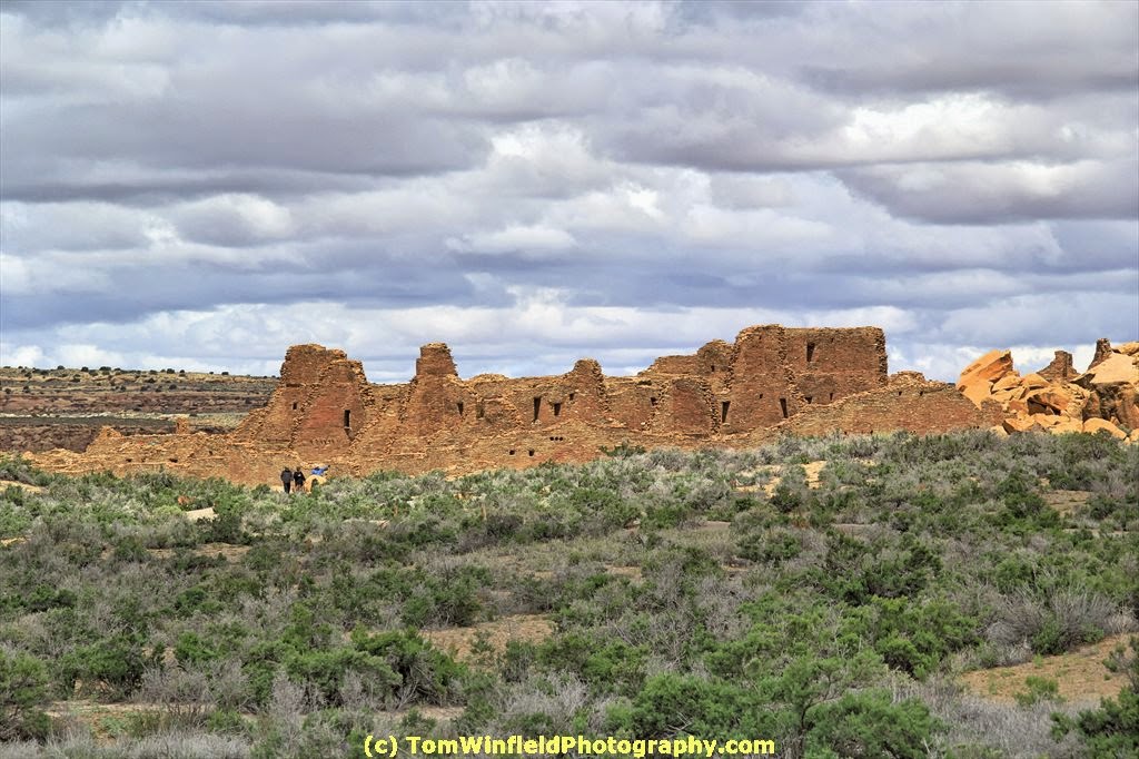
This recent trip, I was able to visit the Chaco Culture National Historical Park in NW New Mexico. From books I picked up at the Park, the Chaco Canyon area was inhabited in the years 850 to 1150 CE. (upper photo) Previous to this time, most of the inhabitants of the area were nomadic tribes.
During that same trip, I visited Aztec Ruins National Monument in Aztec, NM. The Four-Corners area of the USA has many more ruins in what is called the San Juan Basin. It is believed that various settlements in the area where located and moved as climate conditions change.
One of the more interesting parks is Bandelier, with their multi-room masonry buildings and cliff dwellings. All of these settlements had one common factor. The spiritual lives and rituals were centered around the kiva. Many of these settlements had several small kivas and one large kiva.
With the influx of the Spanish Missionaries in the 17th century, the spiritual lives of the native peoples was changed by the Missions. Most of these seem to be in the Rio Grande valley. Undoubtedly, the El Camino Real Historic Trail was a large influence on the creations of missions in the area.
The spiritual center of the pueblo now was the mission church. Life centered around the church. The lower photo is of the Quarai Pueblo Mission. Some of these missions were built on top of the ruins of the earlier settlements.
What is interesting to me is the similarity of construction of their building from the earlier days of the 1100s to later years to the 17th century. Visit National Parks and Monuments to learn all about the early residents of the country.
Aztec Ruins National Monument
Bandelier National Monument
Chaco Culture National Historical Park
El Camino Real Historic Trail
El Morro National Monument
Pecos National Historical Park
Salinas Pueblo Missions National Monument
There are more sites in New Mexico. These are those that I have visited and took some photos. Check out my web site for photos: http://tomwinfield.com/new-mexico/albuquerque-nm.html
This recent trip, I was able to visit the Chaco Culture National Historical Park in NW New Mexico. From books I picked up at the Park, the Chaco Canyon area was inhabited in the years 850 to 1150 CE. (upper photo) Previous to this time, most of the inhabitants of the area were nomadic tribes.
During that same trip, I visited Aztec Ruins National Monument in Aztec, NM. The Four-Corners area of the USA has many more ruins in what is called the San Juan Basin. It is believed that various settlements in the area where located and moved as climate conditions change.
One of the more interesting parks is Bandelier, with their multi-room masonry buildings and cliff dwellings. All of these settlements had one common factor. The spiritual lives and rituals were centered around the kiva. Many of these settlements had several small kivas and one large kiva.
With the influx of the Spanish Missionaries in the 17th century, the spiritual lives of the native peoples was changed by the Missions. Most of these seem to be in the Rio Grande valley. Undoubtedly, the El Camino Real Historic Trail was a large influence on the creations of missions in the area.
The spiritual center of the pueblo now was the mission church. Life centered around the church. The lower photo is of the Quarai Pueblo Mission. Some of these missions were built on top of the ruins of the earlier settlements.
What is interesting to me is the similarity of construction of their building from the earlier days of the 1100s to later years to the 17th century. Visit National Parks and Monuments to learn all about the early residents of the country.
Aztec Ruins National Monument
Bandelier National Monument
Chaco Culture National Historical Park
El Camino Real Historic Trail
El Morro National Monument
Pecos National Historical Park
Salinas Pueblo Missions National Monument
There are more sites in New Mexico. These are those that I have visited and took some photos. Check out my web site for photos: http://tomwinfield.com/new-mexico/albuquerque-nm.html
Friday, February 27, 2015
Traveling With My Bicycles
Plans are to make the booklet available as an e-book for Kindle.
Preface -
"So,
what are you going to do to keep active?" was the question my
cardiac rehab folks asked in my exit interview. After weeks walking
on the treadmill, I knew this was not the solution. My mom walks
with a group. But walking the mall did not appeal me, either.
Hiking is great, but "hiking" amongst the corn fields of
Iowa?
As
a kid, I used to ride a bicycle. Maybe that would peak my interest.
I set out to look at purchasing a bicycle. I started riding local
trails. Soon, I was taking a bicycle with me on trips. These trips
combined my exploring nature, love of photography, and riding my
bicycle.
The trips I take are not for
folks that want to lay on the beach and work on their tan. They are
trips filled with activity yet leaving time to relax, recover and
reflect.
This
booklet is a compilation of what I have learned planning and
implementing these trips. It is not a recipe for the perfect trip.
It is meant to cause you to consider ways to blend activities you
enjoy with things you are passionate about into your travels.
Tuesday, February 10, 2015
Salinas Pueblo Missions
With cool mornings, Monday I decided I would do some "tourist" stuff. From the book "New Mexico Journey Guide" I settled on checking out the old pueblo mission ruins SE of Albuquerque. East on I-40 to the Tijeras exit, South on highway 337 and highway 55 towards Mountainair.
There are 3 ruins sites that make up the Salinas Pueblo Missions National Monument. The first one in this route was Quaria. I was the only visitor when I arrived. The ranger gave me a good synopsis of the history of the pueblo. Then it was time to walk around to see the ruins and take photos.
The site is at about 6500ft altitude. Glad I had just been on the mountain in Pine Cove, CA (about 6000 ft). My knee was bothering more than the altitude.
I walked the loop trail at the site. Back at the visitor's center, I chatted more with the ranger. Picked up a book about the sites. Then, back on the road to Gran Quivira. This site is a bit out if the way - 25 miles South of Mountainiar. But, what the heck, I had all the day. The only thing i was thinking of doing later in the day was a bike ride.
Gran Quivira sits on top of a hill, overlooking the mesa. It also meant a walk up the paved trail (some sections being steep climb) to view the ruins. I took my time. Took photos of the ruins and the valley. By the time I was back down to the visitor's center, my knee was giving me problems. Selected a book about New Mexico parks and a bottle of Powerade (needed the electrolytes and sugar).
On back to Mountainair. Was looking for a place for lunch and a large bottle of Gaterade or Powerade. Downtown Mountainair was busy (at least many cars downtown) but did not see a place to my liking. On over to Abo, the third of the pueblo missons.
The route to Abo and eventually back to Albuquerque paralleled the BNSF main line. Took a couple photos of trains in the hill. Several trains parked and lots of track work on the line. Mountainair is the crest of the hill dropping to the West.
Made a short tour of the Abo ruins site. My left knee was not up to walking the trail. Took a few photos from the road.
Saw many abandoned buildings up on the mesa. Took some photos of those close to the road or interesting construction. Some may end up on my Fine Art America page.
Bye the time I was back at the hotel, I was getting hungry. The first place i looked for along Coors Blvd was not open. Ended up having a pint of bock beer and a bacon cheeseburger at Effingbar & Grill on Sequoia, just off Coors.
Back at the hotel, I watch TV and crashed. Photos with this post are of Quaria Mission, Gran Quivira ruins, and an old barn along US 60.
There are 3 ruins sites that make up the Salinas Pueblo Missions National Monument. The first one in this route was Quaria. I was the only visitor when I arrived. The ranger gave me a good synopsis of the history of the pueblo. Then it was time to walk around to see the ruins and take photos.
The site is at about 6500ft altitude. Glad I had just been on the mountain in Pine Cove, CA (about 6000 ft). My knee was bothering more than the altitude.
I walked the loop trail at the site. Back at the visitor's center, I chatted more with the ranger. Picked up a book about the sites. Then, back on the road to Gran Quivira. This site is a bit out if the way - 25 miles South of Mountainiar. But, what the heck, I had all the day. The only thing i was thinking of doing later in the day was a bike ride.
Gran Quivira sits on top of a hill, overlooking the mesa. It also meant a walk up the paved trail (some sections being steep climb) to view the ruins. I took my time. Took photos of the ruins and the valley. By the time I was back down to the visitor's center, my knee was giving me problems. Selected a book about New Mexico parks and a bottle of Powerade (needed the electrolytes and sugar).
On back to Mountainair. Was looking for a place for lunch and a large bottle of Gaterade or Powerade. Downtown Mountainair was busy (at least many cars downtown) but did not see a place to my liking. On over to Abo, the third of the pueblo missons.
The route to Abo and eventually back to Albuquerque paralleled the BNSF main line. Took a couple photos of trains in the hill. Several trains parked and lots of track work on the line. Mountainair is the crest of the hill dropping to the West.
Made a short tour of the Abo ruins site. My left knee was not up to walking the trail. Took a few photos from the road.
Saw many abandoned buildings up on the mesa. Took some photos of those close to the road or interesting construction. Some may end up on my Fine Art America page.
Bye the time I was back at the hotel, I was getting hungry. The first place i looked for along Coors Blvd was not open. Ended up having a pint of bock beer and a bacon cheeseburger at Effingbar & Grill on Sequoia, just off Coors.
Back at the hotel, I watch TV and crashed. Photos with this post are of Quaria Mission, Gran Quivira ruins, and an old barn along US 60.
Sunday, September 7, 2014
First Air-Conditioned Combine Cab?
Another installation of my memoirs - Son of a Sharecropper
My dad and I spent many hours
operating the farm equipment. When you spend money for the
equipment, you need to keep it busy to pay for it. The
self-propelled combine was a workhorse. My dad purchased a
Massey-Ferguson combine with 13 foot grain head and a corn picker
head.
The combine was running
through the whole harvest season. First there was winter wheat and
oats. New came soy beans. Finally, corn. In those days, corn
varieties required longer growing season – so Beans were mostly
done before corn was ready for harvest.
Most of the combining was done
by my dad. The operator's platform was open. It was a dusty job,
particularly with the soy beans. The fine “hairs” of the bean
stalk would swirl as a dust cloud. The dust was having an adverse
effect on my dad's health. The answer was installing a cab on the
combine.
As I recall, there was a fan
and filter to circulate the air. No problems in Fall beans and corn
harvesting. Engine heat and the sun (lots of glass in the cab) kept
the cab comfortable. The problem was wheat and oats harvesting. Hot
days in the fields.
During the summer, we were
very busy. Once I was old enough, my dad taught me how to run the
combine. I am sure I was in high school (or summer break from
college). This makes it in the mid 60s.
I was running the combine. It
was a hot, sunny day. Had the roof and door of the cab open in an
effort to keep the cab temperature bearable. My mom came out to
bring me lunch. Back in the cab, the heat became unbearable.
Trying to cool down, I was trying standing up on the seat, partially
out of the roof of the cab. Suddenly, I felt cool, almost chilly.
I recognized the condition as
being overheated and nothing to fool around with.. Drove the combine
to the truck and then home. My mom was surprised to see me home.
When I told here what happened, she got me cold water, started up a
fan, and had me lay down.
When my dad got home, he said
something has to be done. Can't afford missing the harvest days, but
can't have heat stroke as a common occurrence. His solution was
air-conditioning the combine cab. The implement dealer said they had
not heard to anyone doing this, but were interested in the concept.
Montgomery Wards had
aftermarket automobile air-conditioners. They were willing to work
with the implement dealer to design the application.
The combine had a Chrysler
slant 6 engine – no problem powering the AC pump. The evaporation
unit was mounted top inside of the cab for fan blowing at the
operator's face. Wish I had a photograph of the installation.
As I recall, other farmers and
implement dealers came to look at the installation. The local
newspaper published an article and photo about the installation.
According to Massey-Ferguson, my dad had the first air-conditioned
combine.
I have asked for a copy or the original item in the newspaper. A copy is shown here that my mom had copied for her autobiography. The newspaper photo incorrectly identified me as the in the cab - it is my dad.
Subscribe to:
Posts (Atom)