Wednesday, September 28, 2011

Damage Near Silver Creek Bridge


On Monday, I took the day off the bike. Was a bit windy, anyway. By Tuesday (yesterday) I was needing a ride. Forecast was for sunny, temp in the upper 70s, and a wind out of the NNW. With the wind, i decided to ride the Trace from Silver City to Malvern.

Was a nice, easy ride South to Malvern. Met a few other riders out on the trail. Caught a nice photo of harvesting though the trees on the Trace.

Knew it would be work on the way back up to Silver City into the wind. Took it easy. Stopped at the shelter just North of the Silver Creek bridge. Wanted to redord the damage done to the shelter. It looks like a vehicle backed (or drove) hitting the supports. (see photo) There were also vehicle tracks beside the shelter.

Ended up with a nice ride at 9.5 mph (about average for me right now on the Trace).

Journey of Hope


Sunday morning I had the necessary layers for a cool (chilly) Sunday Morning Ride. Had my breakfast at Panera but my riding friend did not show. I was not really disappointed - not ready for the cooler riding weather.

With the wind kicking up, I decided to ride the Wabash Trace from CB up to Dumfries. When I got at the trailhead, I found there was a charity ride there - fund raiser for cancer support groups in CB. The ride was the Journey of Hope Bike Ride/Walk for the Winds of Hope. I signed up for the ride, got my ls t-short, and headed up the hill.

Have not done much hill climbing. I sure felt it. My legs were tired by the way I got to Margaritaville. Normal stop there for a granola bar and G2. Back down to the trailhead.

Did my good deed for the day and had my bike ride at the same time!

Sunday, September 25, 2011

Mountain Men Rendezvous


This week has been the Mountain Man Rendezvous at the Western Historic trails Center. I stopped by there yesterday morning after breakfast to check it out.

Since it was relatively early in the morning, there were not many visitors. One of the vendors was cooking up breakfast. Of course, I had already had mine. Visited with one of the "Mountain Men). we is a VietNam vet. Had a good conversation.

In the afternoon I was back one the bike. A few more visitors of the gathering. Since it was mid-afternoon, I was getting a little hungry. In 2009 I was in the 4-corners area. Kept seeing signs about "frybread".

Had never tried it. Since they had some at the rendezvous, I just had to try it. What I got was much like a large, flat doughnut. The "bread" was sprinkled with sugar. Washed it down with lemonade. Got my sugar fix for the ride back.

North Side Tour


Have been a little back in my blogging. Maybe I can catch up this morning.

After the frustrations dealing with the dealership last Thursday morning, I needed a bike ride. In the afternoon, I parked downtown CB and stopped at the bike shop. Had a particular reason to stop at the bike shop - drop off some calendars.

Decided to check out the trails on the North side of town. Rode city streets up to the Sheriff's Dept. The road to Big Lake is still barricaded (as of Thursday - see photo). Water is basically under the railroad and I could see lots of clean-up activity in the park. I would not be surprised to see that Big Lake Park open now or very soon.

As I rode Iowa Riverfront Trail, I realized that some of the pumps have been shut down. The river level is continuing to drop. Standing water along the golf course is receding (tells me that they are slowly getting the ground water level under control).

Survey stake all along the level. Some makings on the pavement - looks like sections that will be replaced. Some sections have been almost destroyed by trucks and equipment driving on the levee during the flood.

Shot the lower photo here overlooking the lower level of Harrah's parking garage. From what I could see it looks like the water is nearly gone in the lower level. They have lots of cleaning up to do, clearing all the water silt, but perhaps they may soon open the section of the bicycle trail there.

On the way back, I looked at the area South the the Bob Bridge where the CB was building the new park/green space between the levee and the river. The area looks like coastal tidal flats.

Lots of devastation along the river. Much of the island between the river and chute is gone (maybe more will be visible after the river level gets down to normal). Many trees have died and are dying from toppling in the storms and high water.

Friday, September 23, 2011

Royal CF

Yesterday I opened envelopes from Classic (the car dealer). I was expecting a survey on the purchase/sales gal. Thankfully, I was at Panera Break for coffee. One of the envelopes was my title application paperwork. This was the same paperwprk I had been told that the dealership had sent to the bank a week ago.

At the dealership, (have I told you that almost every time I am in there, I get a different person and different answer) I was told that I got my own financing, they mailed me the paperwork. No explanation as to what too a week!

So, back to the bank where my banker took the paperwork and was forwarding it to their title office. The paperwork MAY make it to the county treasure office before my 30 days. Hope I do not get any penalty (here we have 30 days to register a vehicle).

Tuesday, September 20, 2011

Waters Receding


After a week off the bike, it was time to get out for a ride. Weather was gorgeous when I headed out to the Wabash Trace Trailhead. It was a sunny, 74 degrees, with a slight breeze. Brought the road bike for some pavement miles. First destination was the Western Historic Trails Center.

Barricades where down as I headed out from the trailhead. A good sign that the mud had been cleaned from the trail along Mosquito Creek. As I approached the railroad underpass, I saw that the trail is clear - just a small bit of water still draining from the hill/mud.

Ground water around Lake Manawa is still very high. The low spot near the Nature Trail parking lot is still under water. Next stop was at the Missouri River boat landing. More of the road and larking lot are now visible as the waters recede.

At the Trails Center, I rode up to the levee to see the conditions of the trail behind the center. Its going to be some time before this section of the trail is dry, cleared, and rideable. Today's photo shows the trail behind of the Trails Center.

Uneventful ride to the bike shop. Stop for a rest and G2. Finished the ride down Harry Langdon to the trailhead. Grade A bike ride.

Thursday, September 15, 2011

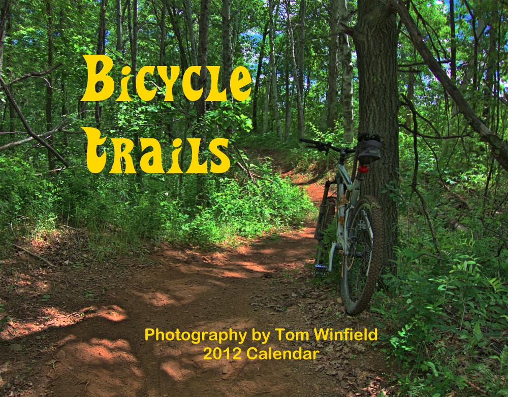
2012 Calendar


The 2012 Bicycle Trails calendar is currently at the printer. I would have them for sale next week. You can reserve your copy by writing to: photos (at) TomWinfield (dot) com. Calendars are $15.00 plus $3.00 shipping (US Only). Iowa residents add 7% ($1.05) sales tax. PayPal accepted.

A PDF version of the calendar is available for viewing at my photography site: http://www.tomwinfieldphotography.com/sale/BicyclesTrails12.pdf

My photos are not the wide, sweeping views typical of calendars. They provide an intimate view of the trail I was riding at the time. All photos on the calendar were taken while riding one of my bicycles.