Was a busy day. Reloaded the car and went to the motel office for coffee and check-out. The desk clerk at the Rim Rock Inn seemed to have disappeared. I waited so I could get a receipt. When he was got back, commented that he needed to do something and he spends 23 or 24 hours in the motel.
Went down to the intersection with Rt 12. Had coffee and cinnamon roll at Castle Rock Coffee & Candy. Nice little shop with coffee, candy, sandwiches, and free internet wi-fi.
Looking forward to driving Utah's Scenic Byway Route 12. The road came to my attention with a episode on Motion on the LiveWell Network.
Headed South on Utah Scenic 12. The road climbed up to the pass on Boulder Mountain. Dropped into Boulder and turned left onto Burr Trail Road. This road is paved out to Capitol Reef.
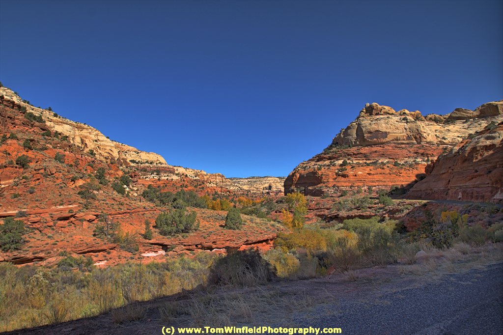
Leading Boulder, a sign said that I was entering Grand Staircase - Escalante National Monument. The first 10 miles on Burr Trail were uneventful. At mile 10, the road dips into a canyon. I was able to identify the slot canyon trailhead highlighted in Motion. The road then wound through the canyon for about 10 miles. The last 10 miles were again unremarkable.
The lower photo in this post was Burr Trail along mile 11.
Back at Boulder, I wanted to get a couple more miles before lunch. Turned South on Scenic 12 and drove until Escalante. Stopped at The Prospector Restaurant. Seemed the take forever to get lunch. The server told me the cook had to get out to the store because they were out of cheese.

Stopped in Tropic to gas up - figured it would be better price than at Bryce. The price at Tropic was $3.999. Not so bad considering I paid $4.169 in Torrey! Moab was $3.899.
A would be a quick drive to Bryce. Knew I was getting close because the hoodoos are starting to be visible. Stopped at the Bryce Canyon Visitor's Center. Checked on best sunrise and sunset view locations. Surprising, it was NOT either Sunrise Point or Sunset Point. The recommendation was either Inspiration Point or Bryce Point.
It was getting close to the hours of optimum sunset view, I drove the park drive, stopping at many of the view points and take photos. Made it all the way to the end (Rainbow Point), and took photos before going Bryce Point. By the time that I was done there, the shadows were getting too long.
Checked into the Bryce View Lodge. Went over to Ruby's (Bryce's version of Wall Drug). Picked up a couple post cards and some reading material. Settled in the room and processed the day's photos.
Having problems uploading to my web sites at this motel. Cannot access the "public_html" directory. Maybe a port restricted on their router. Will deal with it at the next spot. Hate it when places like this block ports.

No comments:
Post a Comment